


Ziyuan III Satellite Images Contributes to MAP WORLD
SOURCE: China Space News
UPDATED: 2012-03-01
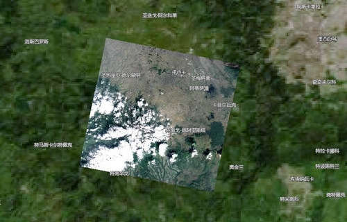
The satellite image is of Mexico's Toluca state, according to a statement of the Bureau of Surveying and Mapping (SBSM). The image covers the area between 99°40' -100°00' west longitude and 18°90' -19°45' north latitude.
Clouds seen in the picture are caused by local weather conditions, said the statement on the bureau's website.
Ziyuan III satellite has so far provided about 10,000 square kilometers of high-resolution satellite visual data for MAP WORLD, including images of the port city of Dalian in Liaoning, Qiangtangjiang in Zhejiang, Ordos in Inner Mongolia. More high-resolution imagery is expected to be added to the mapping service, according to the statement.